Indonesia
lies between latitudes 11°S and 6°N, and longitudes 95°E and 141°E. It consists
of 17,508 islands, about 6,000 of which are inhabited. These are scattered over
both sides of the equator. The largest are Java, Sumatra, Borneo (shared with
Brunei and Malaysia), New Guinea (shared with Papua New Guinea), and Sulawesi.
Indonesia shares land borders with Malaysia on Borneo, Papua New Guinea on the
island of New Guinea, and East Timor on the island of Timor. Indonesia shares
maritime borders across narrow straits with Singapore, Malaysia, the Philippines,
and Palau to the north, and with Australia to the south. The capital, Jakarta,
is on Java and is the nation's largest city, followed by Surabaya, Bandung,
Medan, and Semarang. At 1,919,440 square kilometers
(741,050 sq mi), Indonesia is the world's 16th-largest country in terms of land
area. Its average population density is 134 people per square kilometer (347 per
sq mi), 79th in the world, although Java, the world's most populous island, has
a population density of 940 people per square kilometer (2,435 per sq mi). At
4,884 metres (16,024 ft), Puncak Jaya in Papua is Indonesia's highest peak, and
Lake Toba in Sumatra its largest lake, with an area of 1,145 square kilometers
(442 sq mi). The country's largest rivers are in Kalimantan, and include the
Mahakam and Barito; such rivers are communication and transport links between
the island's river settlements.
Indonesia's location on the edges
of the Pacific, Eurasian, and Australian tectonic plates makes it the site of
numerous volcanoes and frequent earthquakes. Indonesia has at least 150 active
volcanoes, including Krakatoa and Tambora, both famous for their devastating
eruptions in the 19th century. The eruption of the Toba supervolcano,
approximately 70,000 years ago, was one of the largest eruptions ever, and a
global catastrophe. Recent disasters due to seismic activity include the 2004
tsunami that killed an estimated 167,736 in northern Sumatra, and the Yogyakarta
earthquake in 2006. However, volcanic ash is a major contributor to the high
agricultural fertility that has historically sustained the high population
densities of Java and Bali.
Lying along the equator, Indonesia has a tropical climate, with two distinct
monsoonal wet and dry seasons. Average annual rainfall in the lowlands varies
from 1,780–3,175 millimeters (70–125 in), and up to 6,100 millimeters (240 in)
in mountainous regions. Mountainous areas—particularly in the west coast of
Sumatra, West Java, Kalimantan, Sulawesi, and Papua—receive the highest rainfall.
Humidity is generally high, averaging about 80%. Temperatures vary little
throughout the year; the average daily temperature range of Jakarta is 26–30 °C
(79–86 °F).
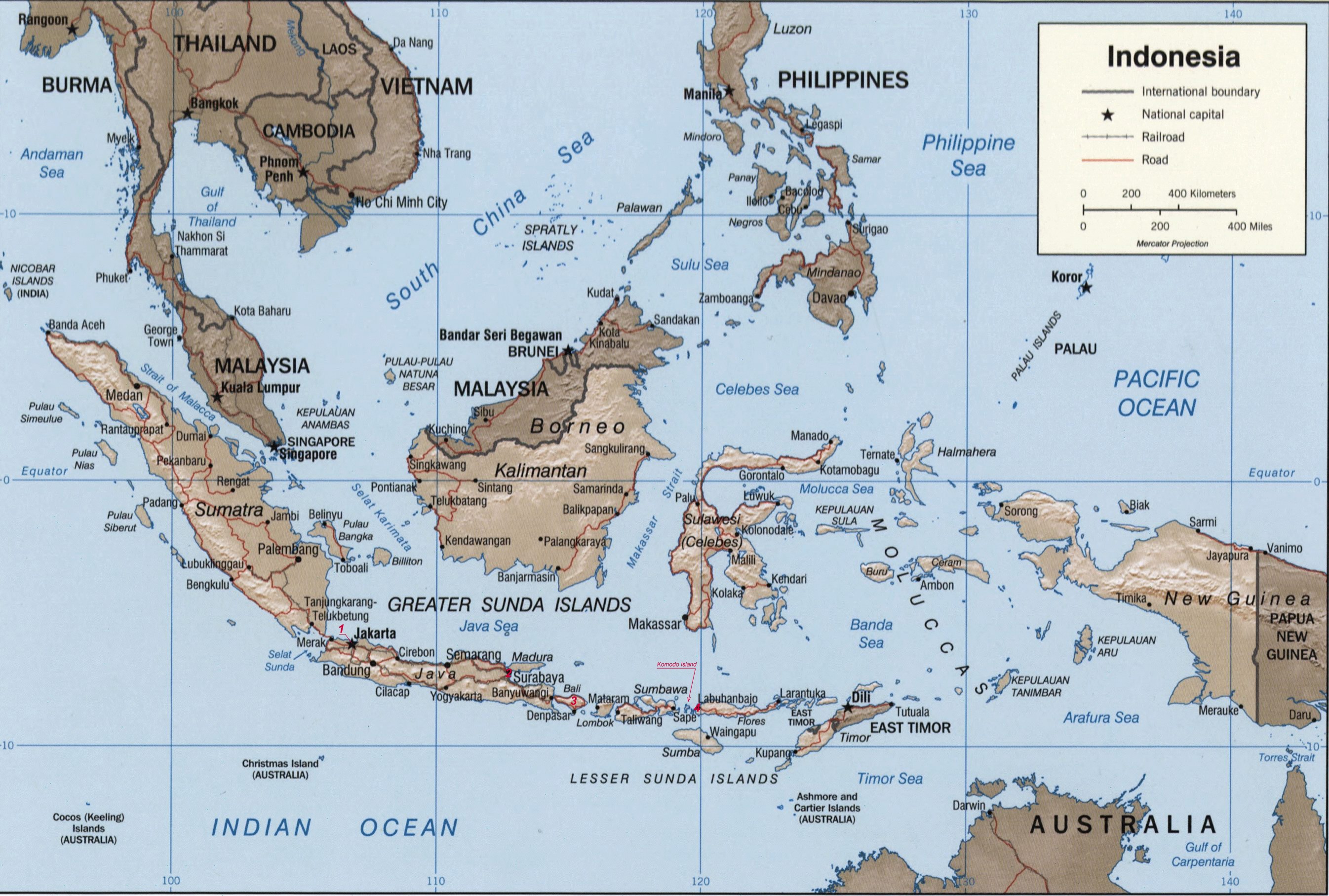 Map of Indonesia, where: 1 - Jakarta; 2 - Surabaya; 3 - Bali; 4 - Labuhanbajo |
The Dutch began to colonize Indonesia in the early 17th century; Japan occupied the islands from 1942 to 1945. Indonesia declared its independence after Japan's surrender, but it required four years of intermittent negotiations, recurring hostilities, and UN mediation before the Netherlands agreed to transfer sovereignty in 1949. After decades of repressive rule, free and fair legislative elections took place in 1999. Indonesia is now the world's third most populous democracy, the world's largest archipelagic state, and home to the world's largest Muslim population. Current issues include: alleviating poverty, improving education, preventing terrorism, consolidating democracy after four decades of authoritarianism, implementing economic and financial reforms, stemming corruption, reforming the criminal justice system, holding the military and police accountable for human rights violations, addressing climate change, and controlling infectious diseases, particularly those of global and regional importance. In 2005, Indonesia reached a historic peace agreement with armed separatists in Aceh, which led to democratic elections in Aceh in December 2006. Indonesia continues to face low intensity armed resistance by the separatist Free Papua Movement.
Our trip shedule...
Our Indonesian trip daily shedule was following:
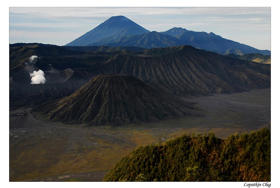
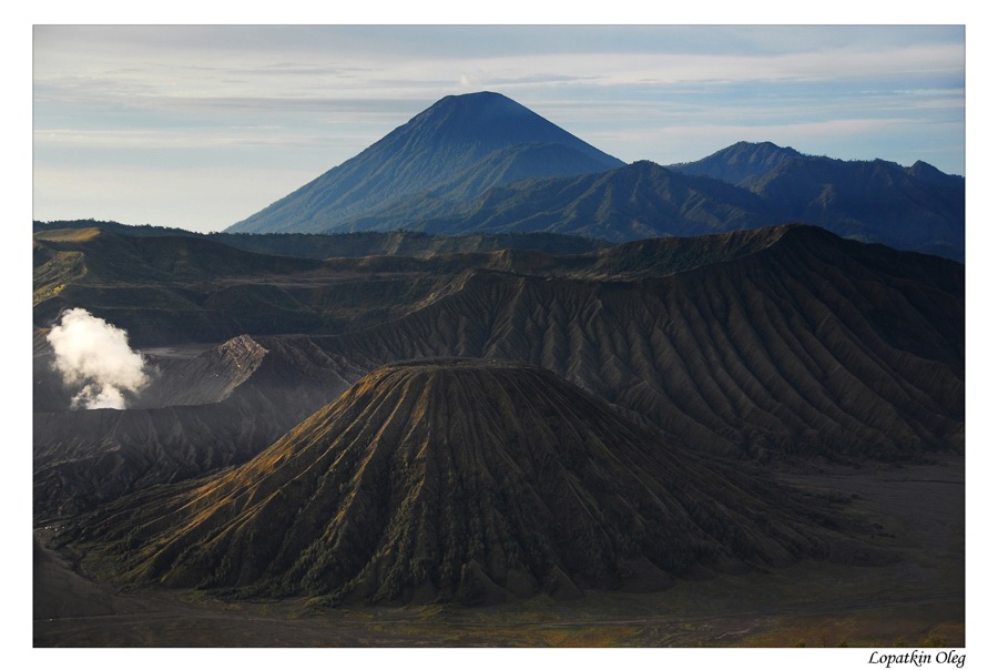
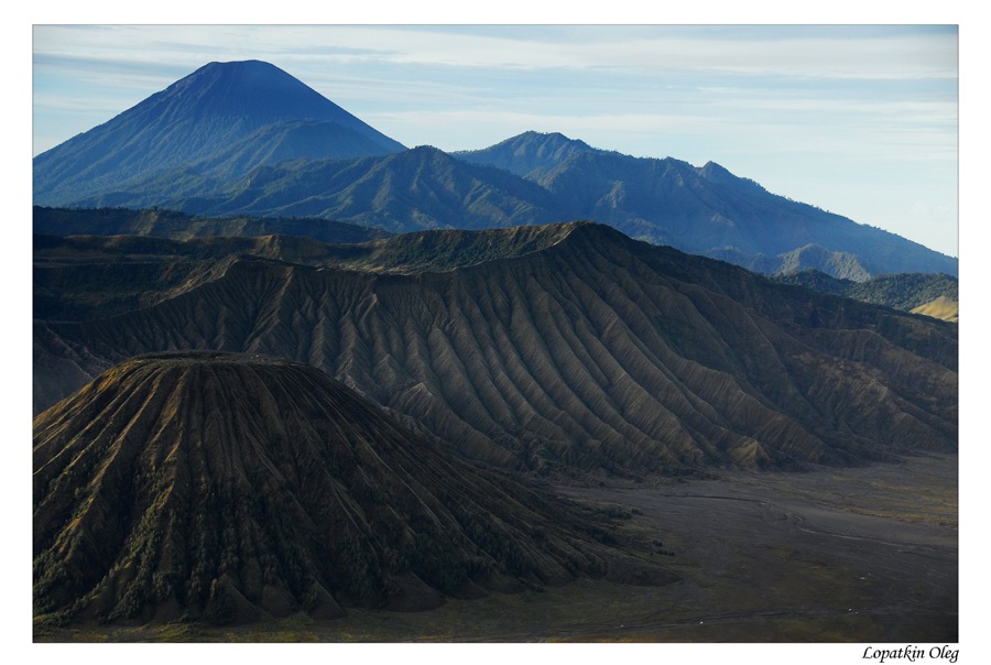
Day 1/2 - MOSCOW - JAKARTA - SURABAYA - BROMO
We have arrived to Soekarno Hatta International Airport by Emirates Airlines at deep evening time. At the next day morning, after overnight stay at Aston Hotel near the airport, our new flight to Surabaya waited us. Upon arrival at Surabaya, we have drove up to Bromo mountain. Our arrival in Bromo highland was at early afternoon.
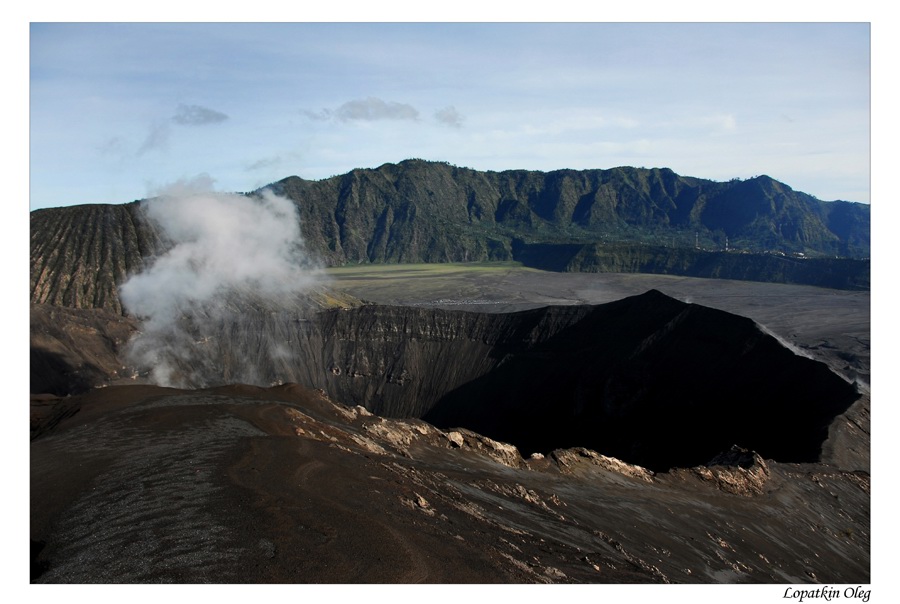
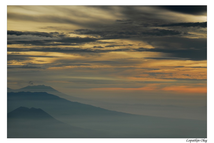
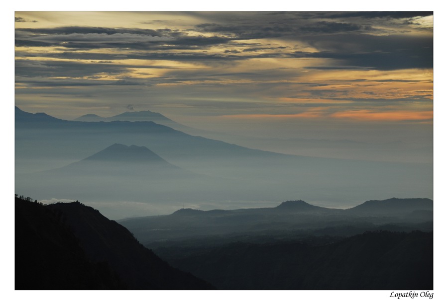
Day 3 - CEMORO LAWANG - PANANJAKAN - SITUBONDO - BANYUWANGI
Another early morning wake up.. By 4 wheel-drive Jeep we have drove up to Mt. Pananjakan (2,770 M asl) for a spectacular view of sunrise over Mt. Bromo and its desert. Return to hotel , and departure to Banyuwangi via Situbondo.
 |
 |
 |
 |
 |
 |
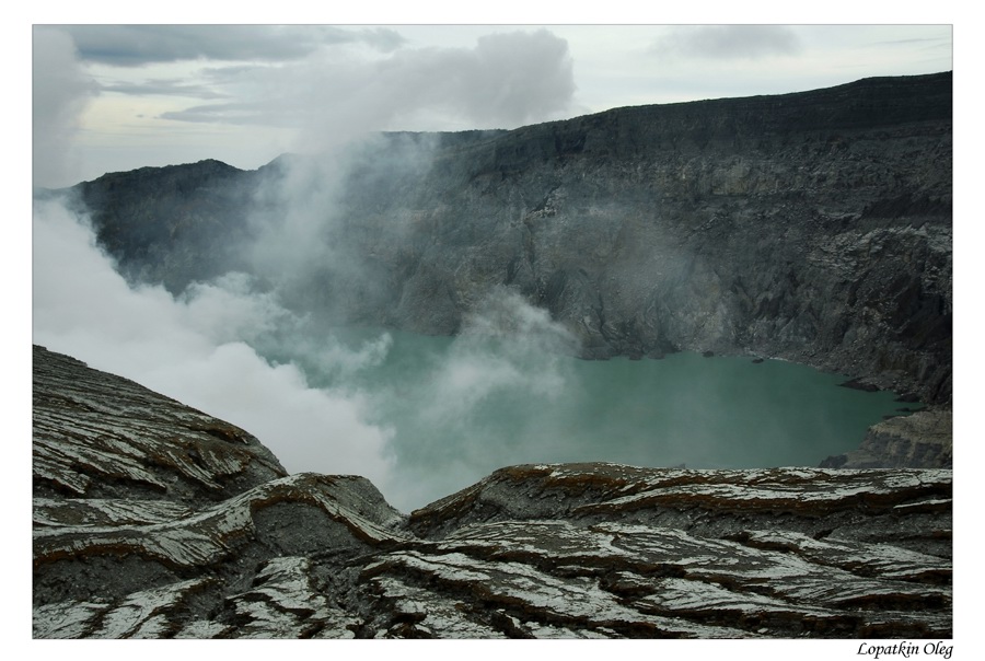
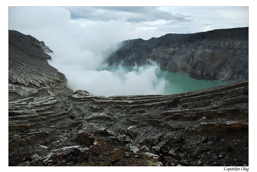
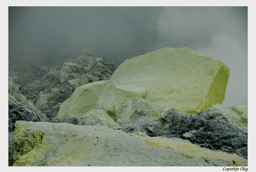
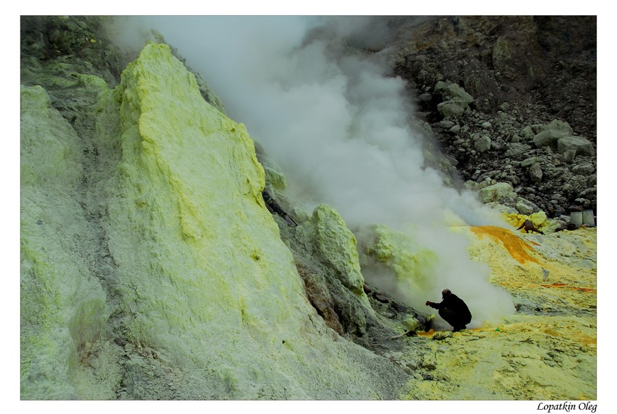
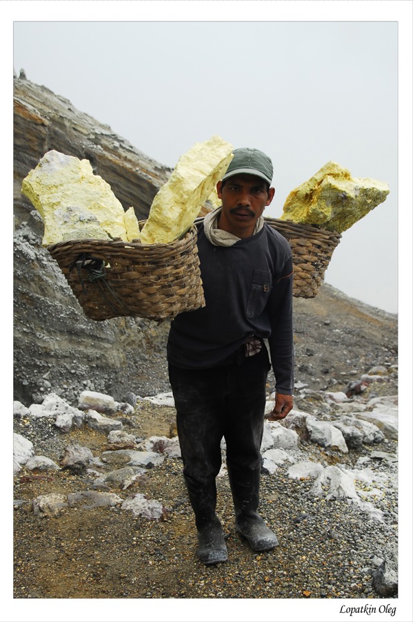
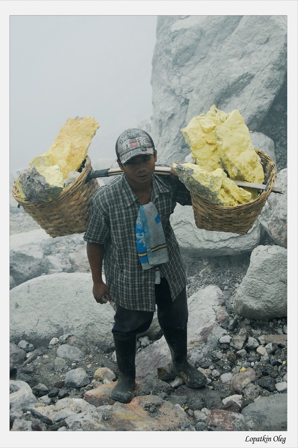
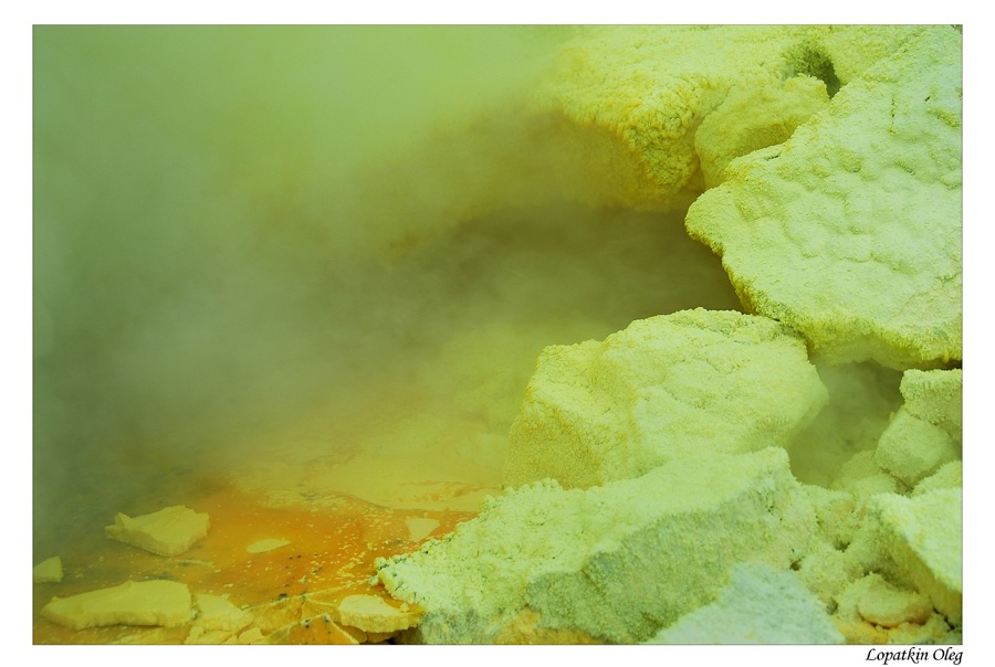
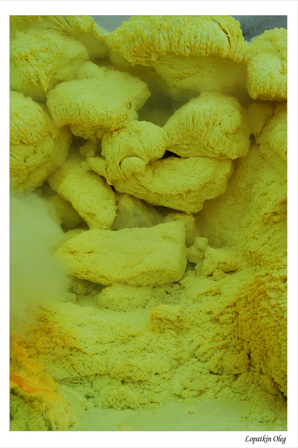
Day 4 - PALTUDING - IJEN - LICIN - BANYUWANGI - SUKAMADE
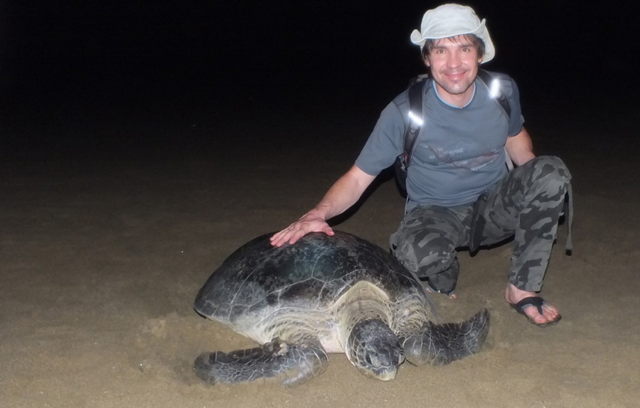
Early morning after breakfast, depart to Paltuding (1800 mtr asl) by 4 wheel-drive. By arriving in Paltuding, we continued to Ijen crater. In Ijen we have started to explore the crater lake and sulphur mine of Ijen Crater (2400 mtr asl). After finish from Ijen, the journey has continued to Sukamade beach in Meru Betiri National Park. After dinner around 9pm - 12pm we have observed how turtles lay their eggs on the beach. Sukamade Beach is location for turtle egg hatchery of the six species of sea turtles in Indonesia, the Green Turtle (Chelonia mydas), Hawksbill Turtle (Eretmochelys imbricata), Slengkrah Turtle (Lepidochelys olivaceae), and the Leatherback turtle (Dermochelys coriaceae). Green turtles often come up to the white sands of Sukamade beach, and visitors can observe them at night. Stay in Sukamade Ranger Guest House.
 |
 |
 |
 |
 |
 |
 |
 |
Day 5 - SUKAMADE TURTLE BEACH EXPLORE
Morning before breakfast at around 6 am, accompanied by National Parks officials, we have released the young turtles (hatchlings) back to sea. After breakfast we have visited the turtle eggs hatch, have done short trekking around the coastal forests Sukamade and trek to Green Bay accompanied by National Park ranger. At free time, after lunch, we enjoyed the natural beauty of the beach Sukamade.
 |
 |
 |
|
Day 6 - SUKAMADE EXPLORING - BANYUWANGI - BALI
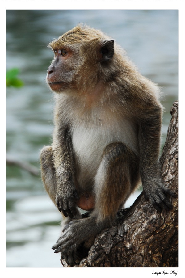
Sukamade is part of Meru Betiri National Park. Meru Betiri National Park has a varied topography reaching from a plain coast to highlands with an altitude of almost 1,200 meters. The park provides habitat for many other protected animals, including 29 species of mammal and 180 species of bird. Among them are the Banteng, Panther, Wild boar, Long-tailed Macaque, Dhole, Javanese Flying Squirrel, Leopard Cat, Javan Muntjac, and Green Peafowl. We have spent half day in the wilderness. After lunch, back to Pesanggrahan village for about 3 hours by 4 x 4, then another 2 - 3 hours to Banyuwangi town From Banyuwangi. Then we have moved from Banyuwangi - Public ferry harbor to cross them to Bali, about 1 hour drive. From here, we have sailed for about 1 hour to Gilimanuk harbor Bali island. From Gilimanuk, have drove to Kuta for about 4 hours, and checked in to Melasti Beach Bungalow.
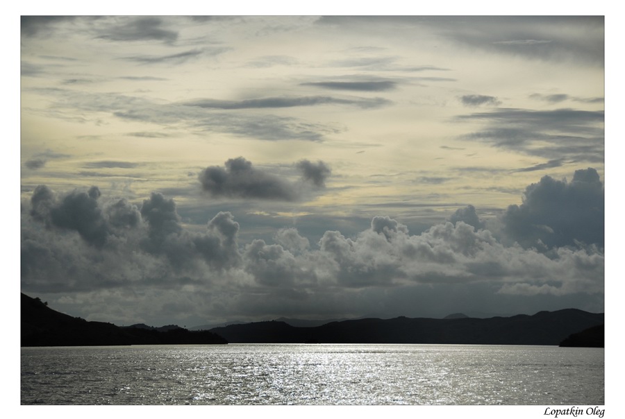
Day 7 - BALI - LABUHAN BAJO - KOMODO ISLAND
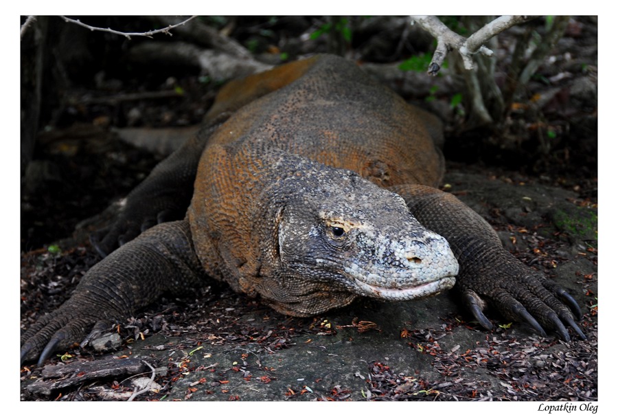
Komodo is one of the 17,508 islands that make up the Republic of Indonesia.
The island is particularly notable as the natural habitat of the komodo dragon,
the largest lizard on earth and consequently named after the island. Komodo
Island has a surface area of 390 km² and a permanent population of over 2,000.
The inhabitants of the island are descendants of former convicts who were
exiled to the island and who have mixed with Bugis from Sulawesi. The population
are primarily adherents of Islam but there are also Christian and Hindu
congregations.
Komodo is part of the Lesser Sunda chain of islands and forms part of the Komodo
National Park. In addition, the island is a popular destination for diving.
Administratively, it is part of the East Nusa Tenggara province.
Komodo national park comprises of 60,300
hectare land and 121,400 surrounding water. There are 5 main islands in
Komodo park, namely Komodo Island, Rinca Island, Padar Island, Gili
Motang, and Nusa Kode. There are still many other
minor islands in between these islands. Among these
islands, only Komodo and Rinca are occupied. Being the
highest point in this park is Satalibo mountain (735 m above sea level).
Komodo is the famous animals in this park, but beside this animal, the
park is also the home for the wild buffalo, deer, wild
horse, wild boar, snakes, birds, and many others.
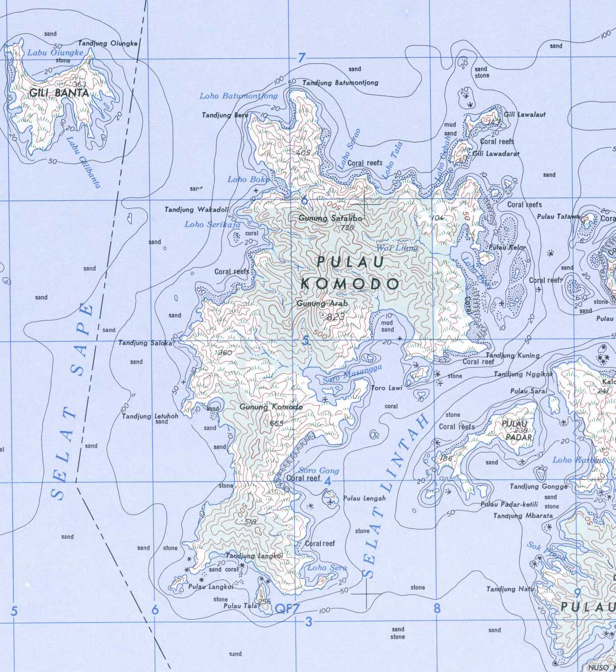 Komodo Island map |
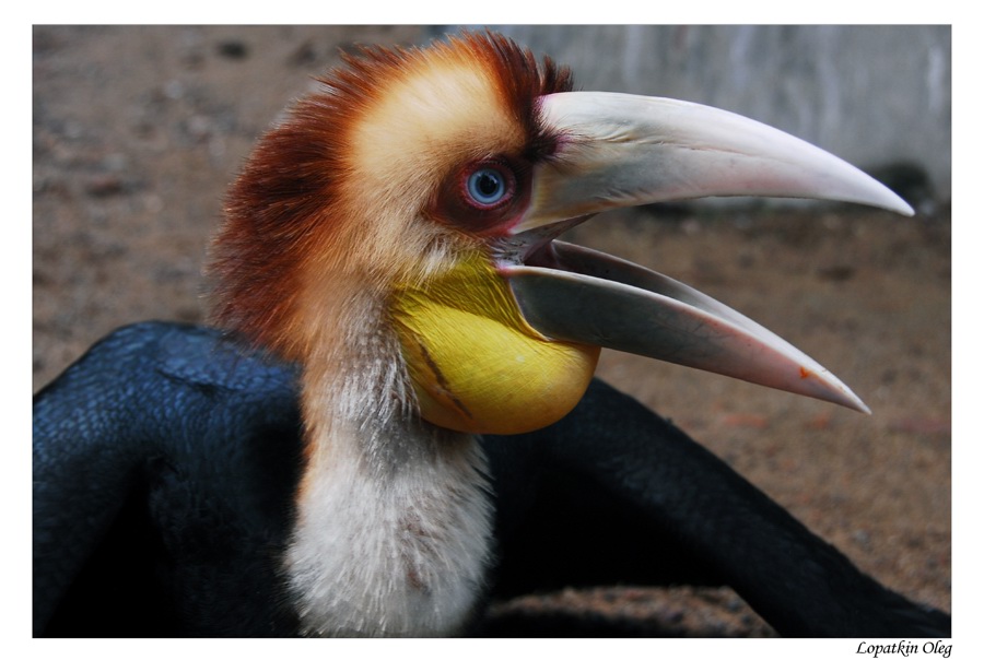
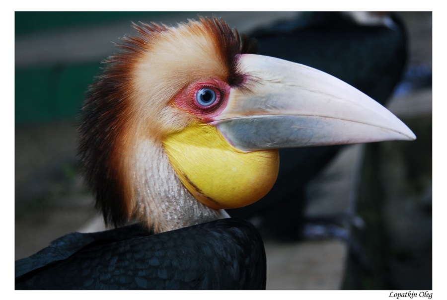
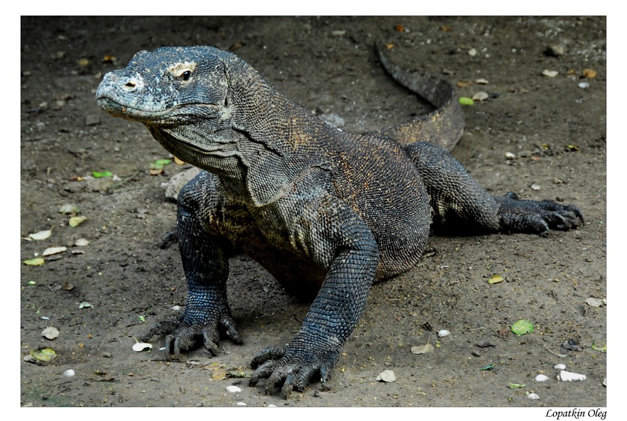
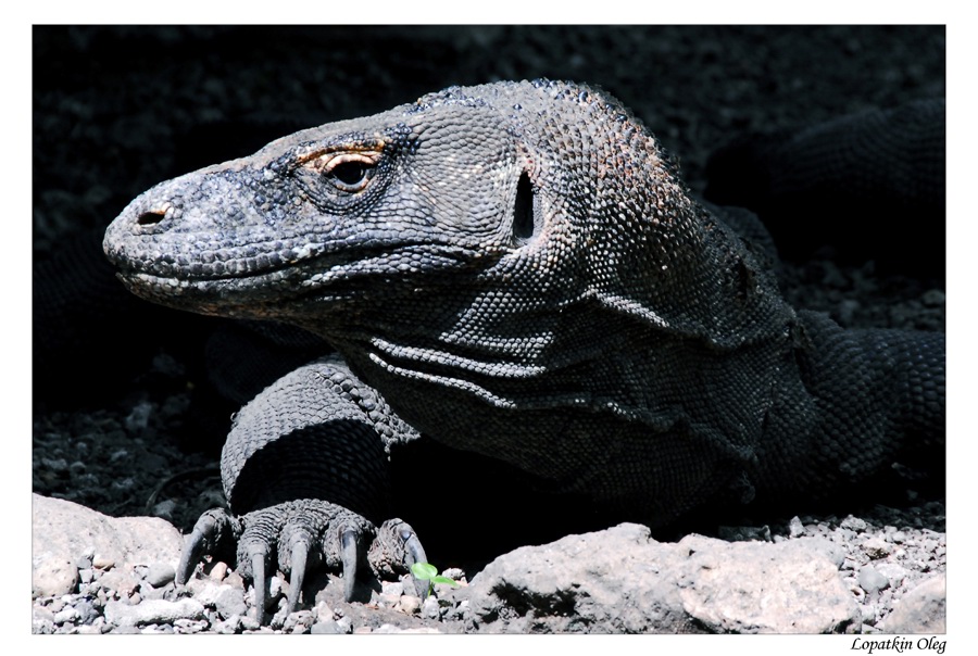
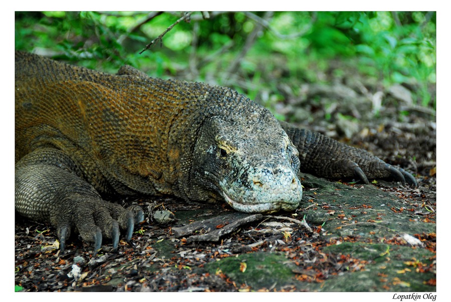
The Komodo dragon
(Varanus komodoensis), that population have a place on
island , also known as the Komodo monitor, is a large species of lizard
found in the Indonesian islands of Komodo, Rinca, Flores, Gili Motang and Padar.
A member of the monitor lizard family (Varanidae), it is the largest living
species of lizard, growing to a maximum length of 3 metres (10 ft) in rare cases
and weighing up to around 70 kilograms (150 lb). Their unusual size has been
attributed to island gigantism, since no other carnivorous animals fill the
niche on the islands where they live.
However, recent research suggests the large size of Komodo dragons may be better
understood as representative of a relict population of very large varanid
lizards that once lived across Indonesia and Australia, most of which, along
with other megafauna, died out after the Pleistocene. Fossils very similar to V.
komodoensis have been found in Australia dating to greater than 3.8 million
years ago, and its body size remained stable on Flores, one of the handful of
Indonesian islands where it is currently found, over the last 900,000 years, "a
time marked by major faunal turnovers, extinction of the island's megafauna, and
the arrival of early hominids by 880 ka."
As a result of their size, these lizards dominate the ecosystems in which they
live. Komodo dragons hunt and ambush prey including invertebrates, birds, and
mammals. Their group behaviour in hunting is exceptional in the reptile world.
The diet of big Komodo dragons mainly consists of deer, though they also eat
considerable amounts of carrion. Komodo dragons also occasionally attack humans
in the area of West Manggarai Regency where they live in Indonesia.
Mating begins between May and August, and the eggs are laid in September. About
20 eggs are deposited in abandoned megapode nests or in a self-dug nesting hole.
The eggs are incubated for seven to eight months, hatching in April, when
insects are most plentiful. Young Komodo dragons are vulnerable and therefore
dwell in trees, safe from predators and cannibalistic adults. They take about
eight to 9 years to mature, and are estimated to live up to 30 years.
Komodo dragons were first recorded by Western scientists in 1910. Their large
size and fearsome reputation make them popular zoo exhibits. In the wild, their
range has contracted due to human activities, and they are listed as vulnerable
by the IUCN. They are protected under Indonesian law, and a national park,
Komodo National Park, was founded to aid protection efforts.
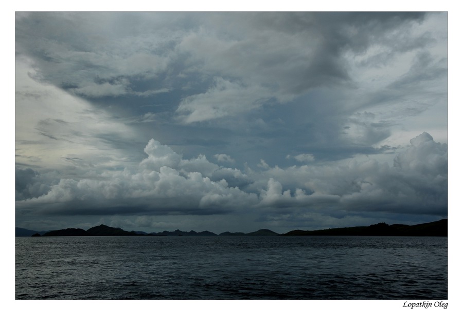
To
reach Komodo island, we booked tickets on flight of Trans Nusa Air to Labuan
Bajo, Upon arrival at Labuhan Bajo, have boarded on a boat and sailed to Komodo
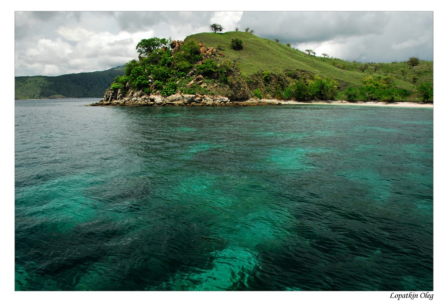
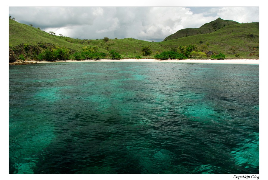
Island. On the way, stopped over at Bidadari island for snorkeling at crystal
clear water and white sandy beach and for lunch. After it, we sailed about 4
hours on our wooden boat to Komodo island. Arrived at the island early
afternoon, and there was some spare free time to make some walk nearby. Stayed
for the overnight on the boat.
 |
 |
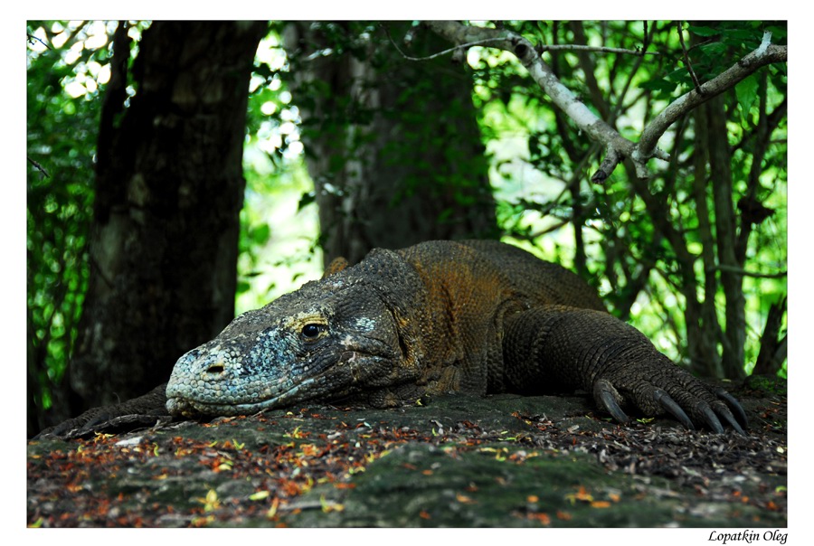
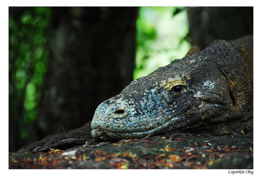
Day 8 - KOMODO - RINCA - KALONG ISLAND
Both early morning and late afternoon is the best time to search for the dragon. Breakfast at the boat,, then walk to Banunggulung, the former feeding site of the dragon. It is about few hrs from the coastal line. After the walk in Komodo, we have sailed to Rinca island. Rinca is another home of the dragon. There are more dragons to see on this island compare to the one at Komodo. But the size of the dragons at Komodo island is slightly larger than the one have a place on Rinca. We have arranged another pleasant walk in Rinca island, to search for the dragon at their natural habitat. Back to the boat after the walk, then have sailed to Kalong island, about 1 hours sail from the big bay of Rinca. Kalong is taken from the flying fox, as the mangrove island complex here is the home of the thousands of flying foxes. They usually seen flying out from the trees every evening, a great attraction to watch from the boat. We stayed at the night time on boat close to Kalong island.
 |
 |
 |
 |
 |
 |
 |
 |
Day 9-10 - KALONG ISLAND - LABUHAN BAJO - BALI ISLAND
Very early in the morning, we have sailed back to Labuhan Bajo for about 2 hours, then from the harbor, we have drove to the airport (15 minutes drive), from where our flight to Bali was arranged. Stayed at Segara Village Bungalow on the Sanur beach, where we have spent two days.
 |
Day 11 - BALI ISLAND - JAKARTA
Many thanks to Adventure Indonesia Co , who have arranged all this trip for us by our request....