This trek completely
around the famed Annapurna Massif offers the most diversity of any trek in
Nepal: fascinating ethnic groups each with their own language, incredible
views of many of the Himalaya's most famous high peaks, and constantly
changing panoramas - from lush, tropical rice paddies and moss-laden.
There are Rhododendron
forests to Tibetan fortresses clinging to rocky cliffs which will definitely
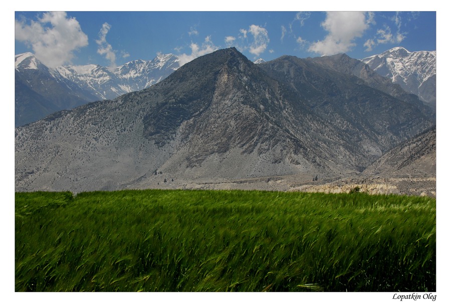
stun you. Starting with a drive to Besisahar you ascend along the Marsyangdi
river valley. We have passed beneath snowcapped Annapurnas II, III and IV and a
range of 6,000m.peaks stretching north to
As this is one of the
most popular trekking routes in
 Map of Annapurna region |
Our program, day by day:
Day 1 Drive from
Day 2 Trek from Beshishahar to
Bahundanda (1310m.) which takes about six hours. The first part of the trail
passes through flat level along the bank of the
Day 3 Trek from Bahundanda to
Chamje (1430m.) and it takes approximately six hours. A steep trail descends
for early half an hour and then follows flat path through rice terraces,
before crossing a stream at the bottom of a small waterfall. It then climbs
again and traverses the hillside high above the river before reaching the
Day 4 Trek from Chamje (1410m.) to Dharapani
(1860m.) and it takes about six hours. The first part of the trail descends
to the river and after crossing a suspension bridge, you begin a climb to
Sattale (1550m.) on a path so steep that it seems one slip would send you
hurtling down into the valley. You continue on an undulating path above the
river, and at one point, where a tributary flows in from the opposite bank,
the main river becomes covered with huge boulders that hide the water.
Climbing the zigzag path to the top of the hill, you see the level, plain of
Tal (1700m.) before you. Tal is the border between Manang and Lamjung
district. Though it is enclosed by cliffs, the level area looks reassuring
after the harrowing mountain paths just traveled on. You descend to a grassy
riverbank, which leads to Tal with its hotels and teahouses. Beyond Tal, the
valley narrows and the path becomes high and winding, and in several areas
hewn from the rock itself. Beyond the small village of Karte (1900m.), there
is a bit more cliff-walking before the path drops again to the river. You
cross a suspension bridge, and climb the short distance to the stone kani
marking the entrance to Dharapani (1960m.), and your camp for the night.
Day 5 Trek from Dharapani to Chame (2670m.) which
takes about five hours. As you cut through a narrow field from the village,
the Dudh Khola, which originates from the south face of Manaslu, enters on
the opposite bank. The Marsyangdi then veers to the left, and as Annapurna II
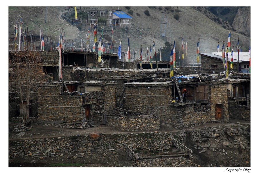
becomes visible ahead, you arrive at Bagarchhap, a Bhote village with prayer
flags fluttering in the breeze around Buddhist monastery. Continuing to climb
through forests of pine and oak, you pass through Danaque (2210m.). There comes
a small wooden bridge which takes you to follow steep ascent path upto
Timang. It lies at the bottom of Lamajung Himal. The trail goes through flat
level until you reach Chame where there are government offices, shops, and
hotels. Chame is the administrative headquarters for the Manang district.
Day 6 Trek from Chame to Upper Pisang (3300m.) which
takes about five hours. With Lamjung Himal (6893m) sparkling in the morning
sun, you set off for Pisang. The mountain disappears as you climb the path up
the valley, passing a huge apple orchard. You continue through a fir and pine
forest, climbing to a high, rocky area as the opposite bank becomes an
impassable cliff. From this point the valley becomes extremely steep-sided as
you follow the path to Bhratang (2950m.).In the past this was the military
station for troops who fought against the Khampa tribal revolution, but the
dilapidated buildings are all that remain of that era. A short climb from the
village brings you to a rock-strewn area where you cross a suspension bridge
and follow a high, winding path, before crossing back to the right bank
again. You now walk through a pine forest and as the forest ends, the valley
changes from a V-shape to a gentle U-shape, opening up a wonderful vista
before you. You can see the east
 |
 |
 |
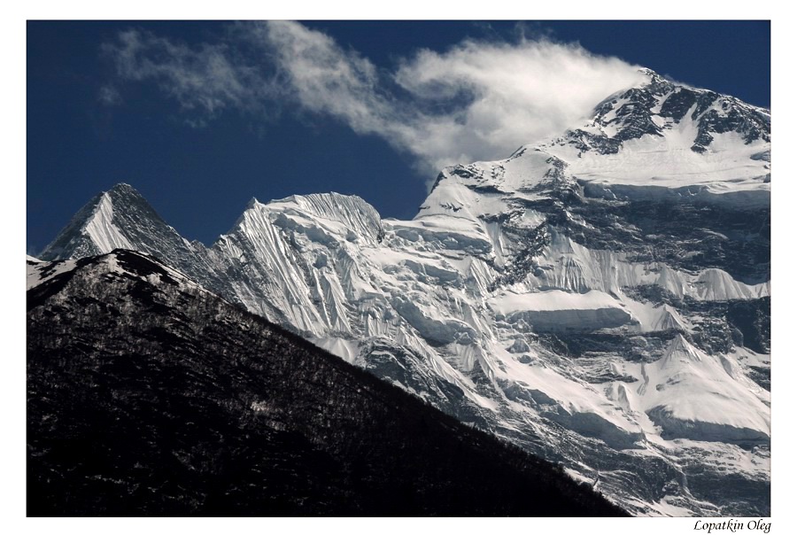
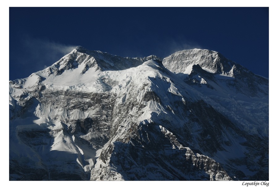
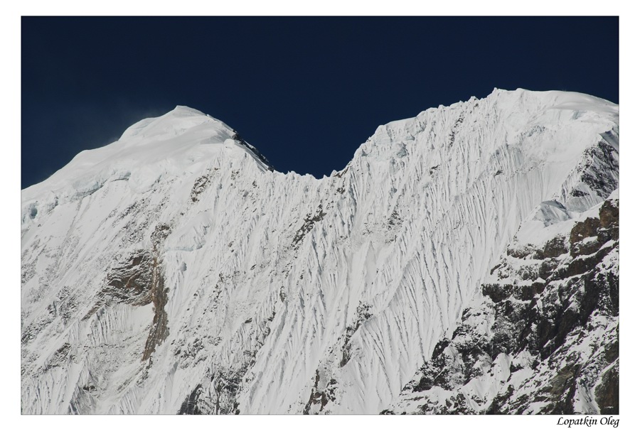
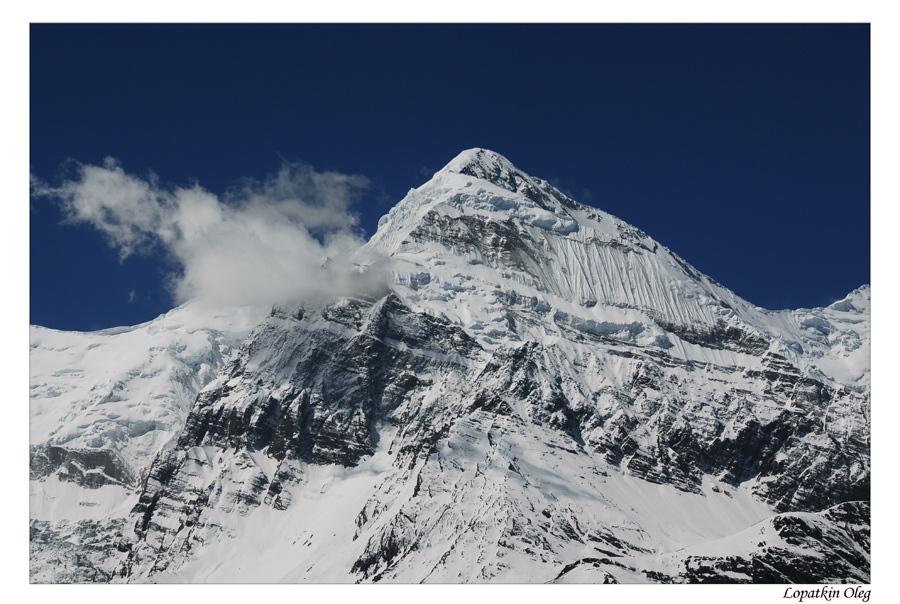
| Views on Annapurna ridge, from Upper Pisang | ||
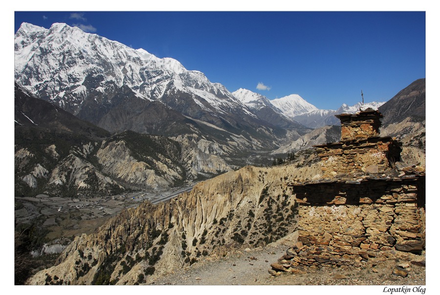
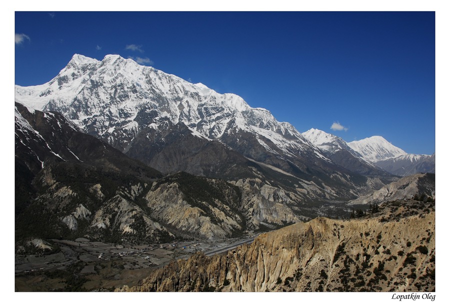
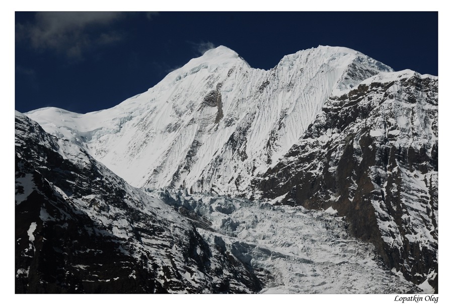
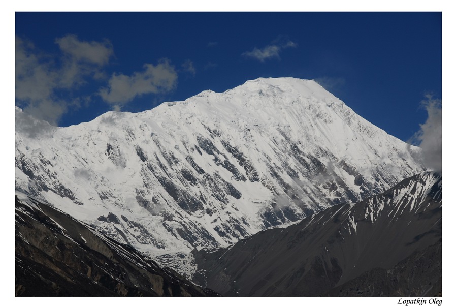
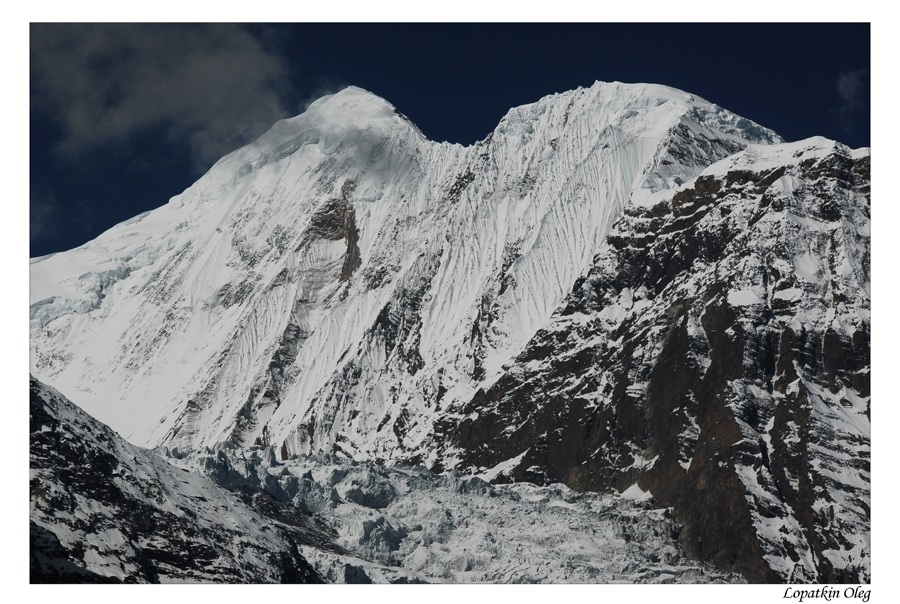
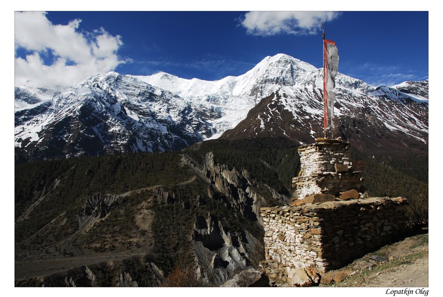
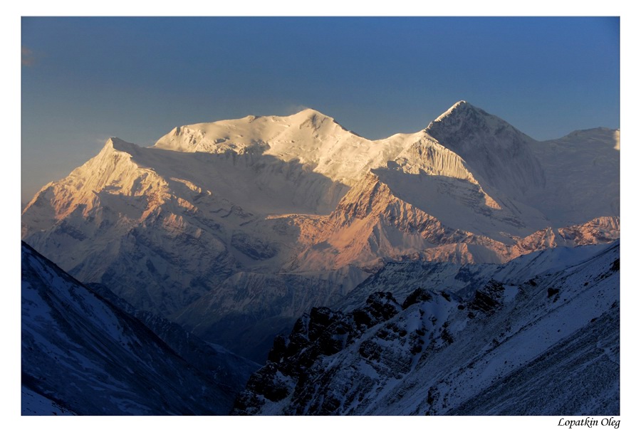
Day 7 Trek from Upper Pisang to Manang (3540m.) and it
takes about five hours. Beyond Pisang, the trail climbs a steep ridge which
affords good views of the Manang valley and Tilicho peak (7145m.). Descending
past Manang's airstrip at Hongde (3320m.), you come to a level area from
where the north-east face of Annapurna III rises majestically above you. From
the wide plains of the
 |
 |
 |
 |
 |
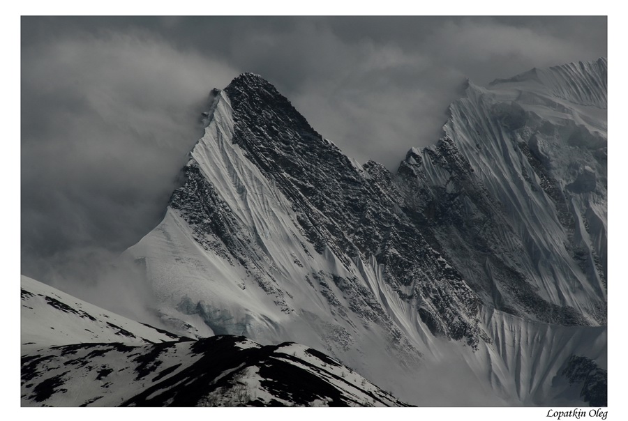
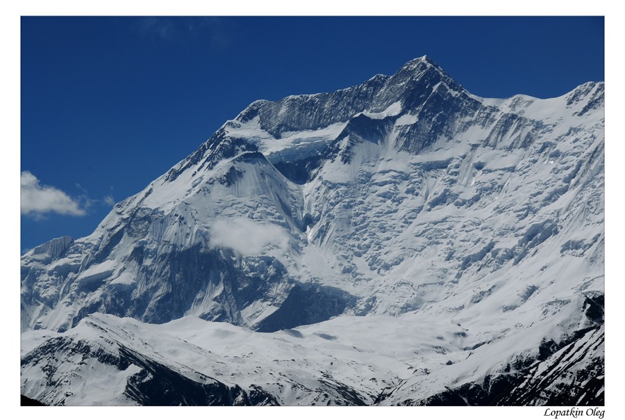
| Views on the way from Upper Pisang to Manang | ||||
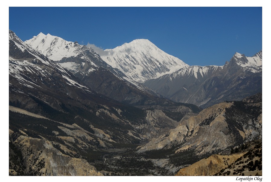
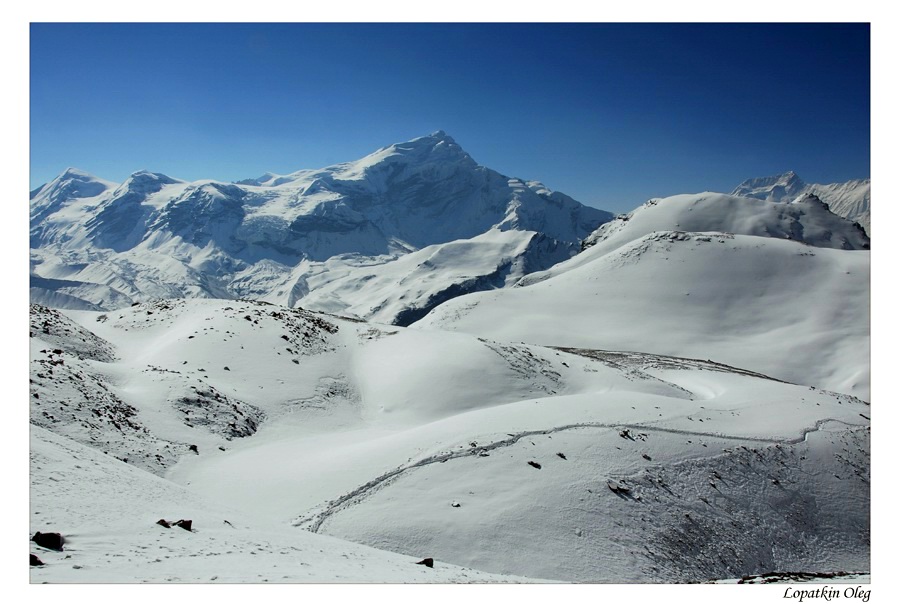
Day 8 Rest day at Manang and hang in and around
town. This is an important rest and acclimatization day before crossing the
 |
 |
 |
 |
 |
 |
 |
|||
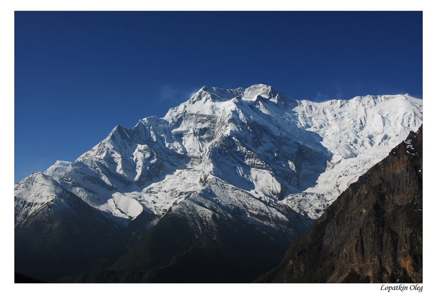
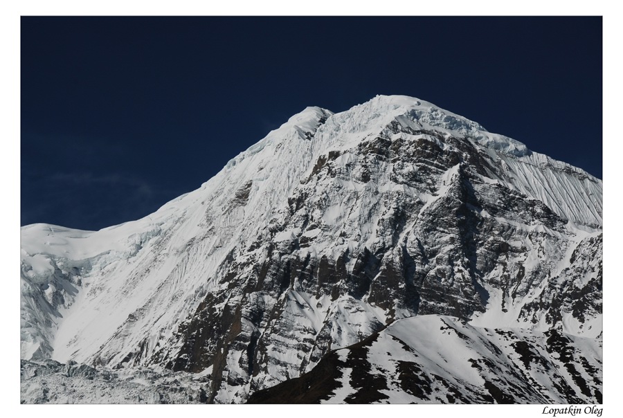
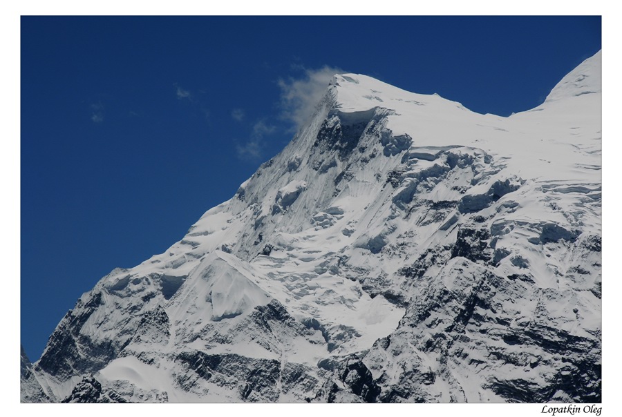
| Manang region views | ||||
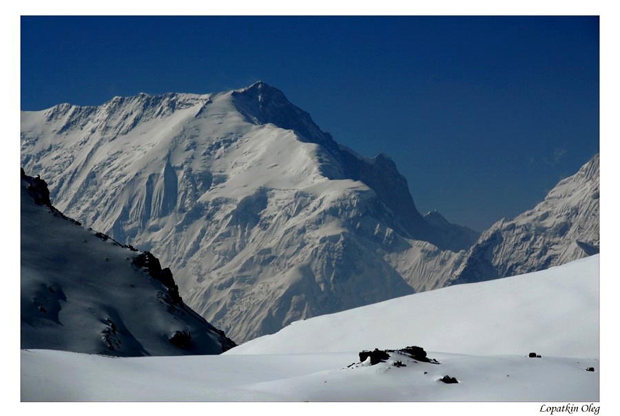
Day 9 Trek from Manang to Yak Kharka (4018m.) and it takes about three and half hours. Now the trail ascends gently all the way to Yak Kharka passing through the Gunsang (3960m.) village. En route, you can see panoramic views all the day.
 |
 |
 |
 |
 |
 |
 |
 |
||
| Views on the way from Manang to Yak Kharka | ||||
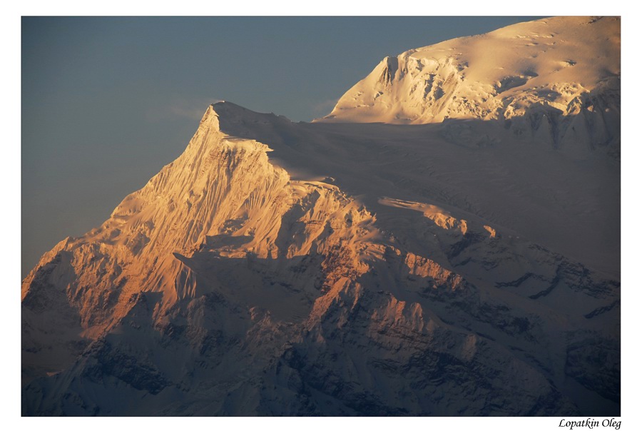
Day 10 Trek from Yak Kharka to Hight Base (4926m.) which takes about 4 and half hours. Leaving Yak Kharka, you climb gradually to a ridge before descending to the headwaters of the Marsyangdi and crossing via a covered wooden bridge. After a short ascent up the mountain path on the right bank, you follow a narrow trail across an unstable spree slope and then descend to Thorung Phedi.
 |
 |
 |
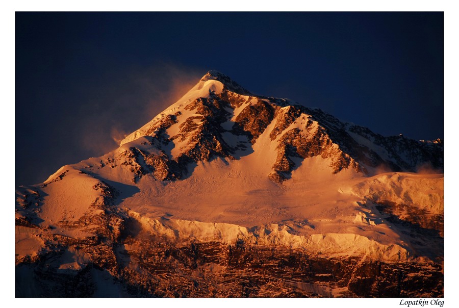
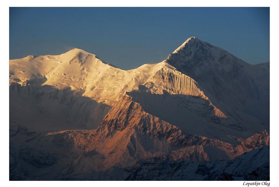
| Views from Hight Base at the sunrise time | ||
Day 11 Trek from Highr Camp to Muktinath (3800m.)
via Thorong La (5416m.) Pass and it takes about seven hours. It demands an
early start today for your crossing of Thorung La [5416m]. The trail becomes
steep immediately on leaving camp but as this trail has been used by local
people for hundreds of years, the path is well defined. The gradient then
eases and after around 4 hours of steady climbing, you reach the chorten and
prayer flags of the pass. The views are dramatic to say the least, from the
snow-covered mountains above, to the head of the Kali Gandaki valley below
and the brown and purple hills of Mustang which are spread out before you.
The descent to Muktinath is a knee pounding 1600m but it is compensated for
with excellent views of
 On the way to Thorong La pass |
 On the way to Thorong La pass |
 On the way to Thorong La pass |
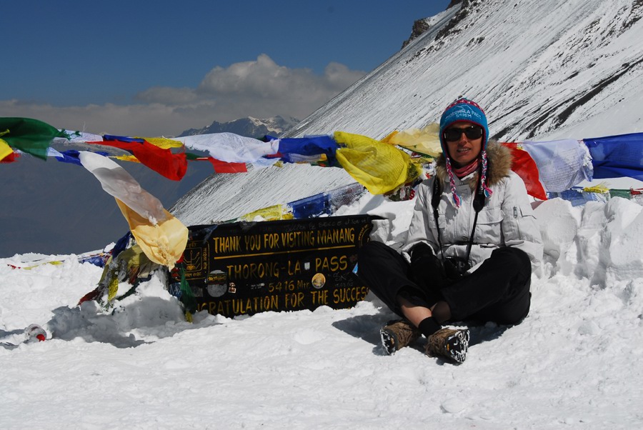 Nelli on Thorong La pass |
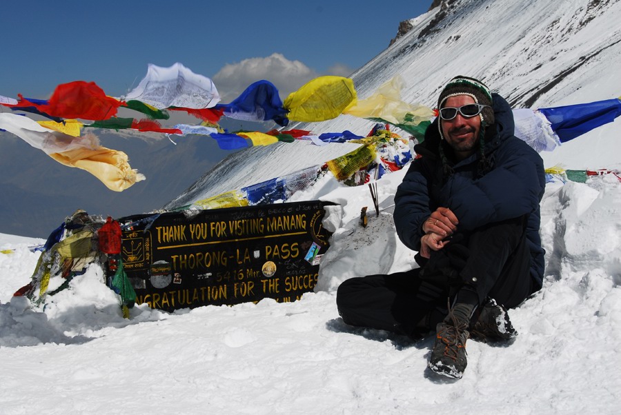 Me on Thorong La pass |
 Sunset in Muktinath |
 Muktinath |
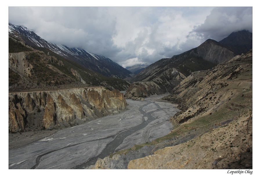
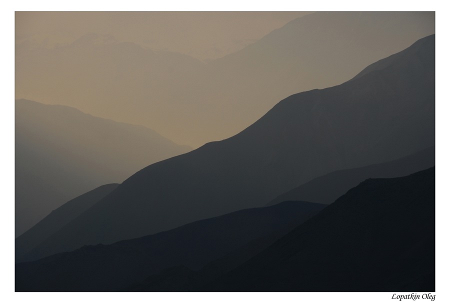
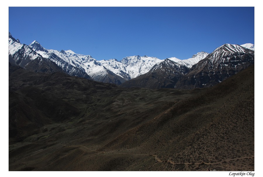
Day 12 Trek from Muktinath to Jomsom (2710m.) via Lumbra village
and it takes
about 5 hours. You now begin the trek descent down the dramatic
Kali Gandaki Gorge, initially through arid country in the same geographical
and climatic zone as
 View on Muktinath valley |
 Muktinath region |
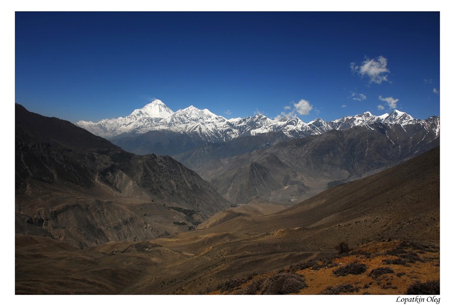
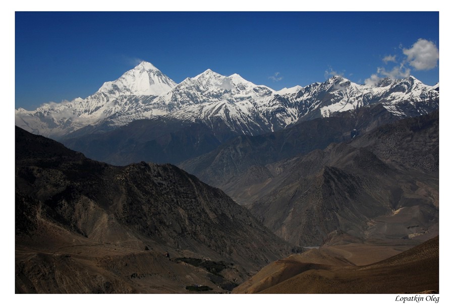
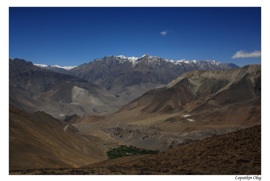 Lower Mustang |
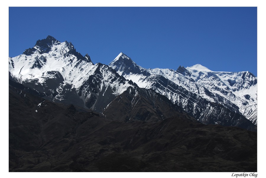
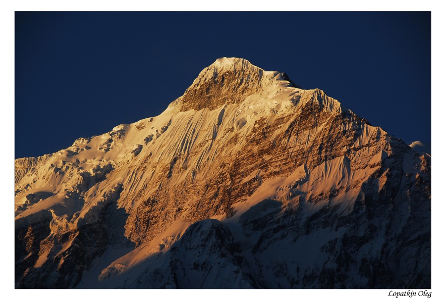
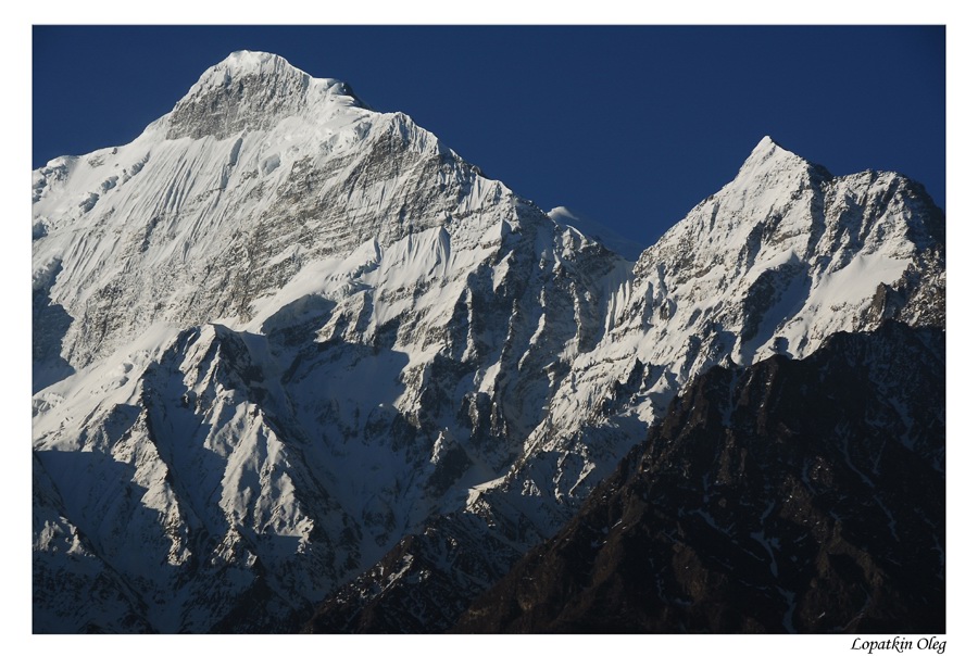
 View on Dhawalagiri ridge |
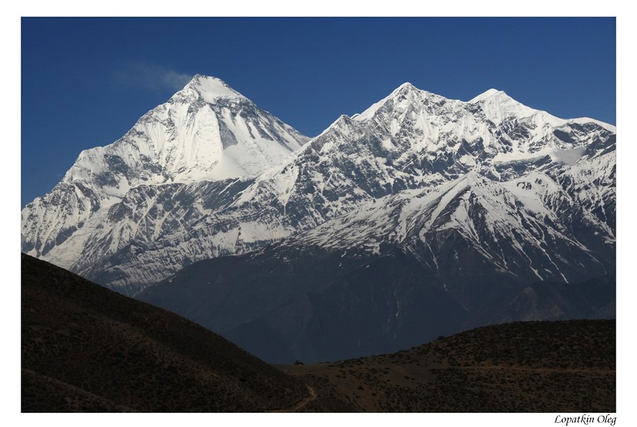 View on Dhawalagiri ridge |
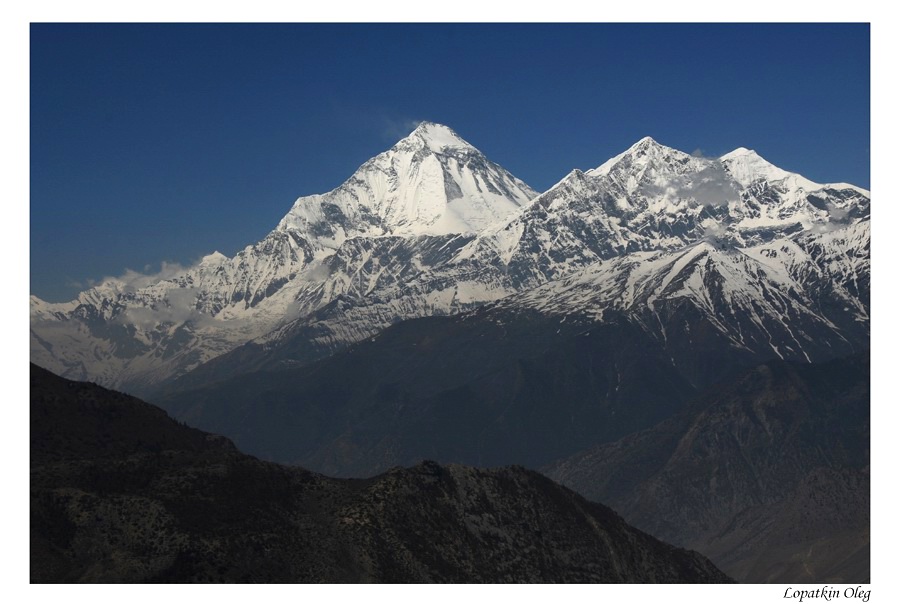 View on Dhawalagiri ridge |
 View on Dhawalagiri ridge |
 View on Dhawalagiri ridge |
 Lower Mustang |
 Lower Mustang |
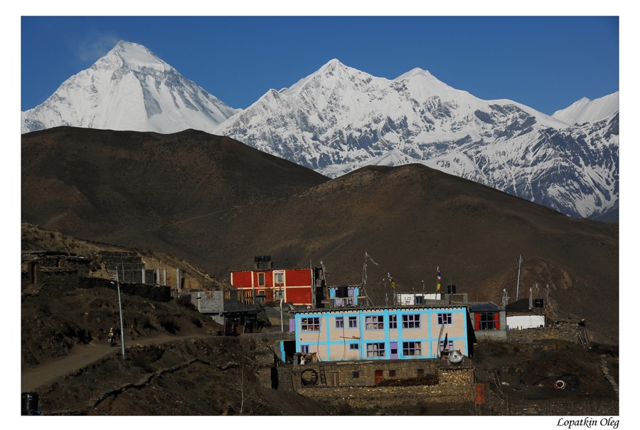
Day 13 Free day in Jomsom.
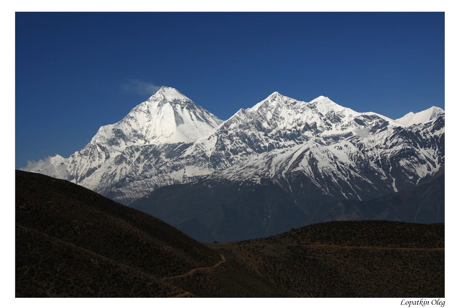
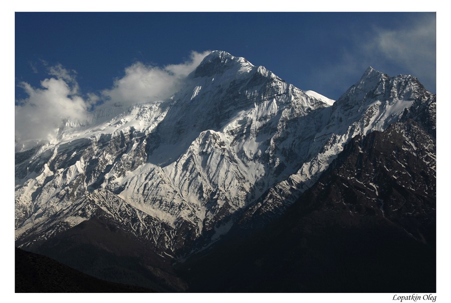
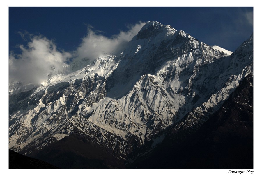
 Nilgiri Mnt. |
 Nilgiri Mnt. |
 Nilgiri Mnt. |
 Jomsom region |
 Jomsom valley view |
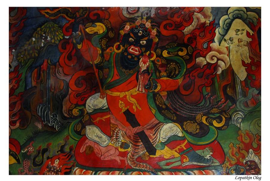 Painting in old monastery |
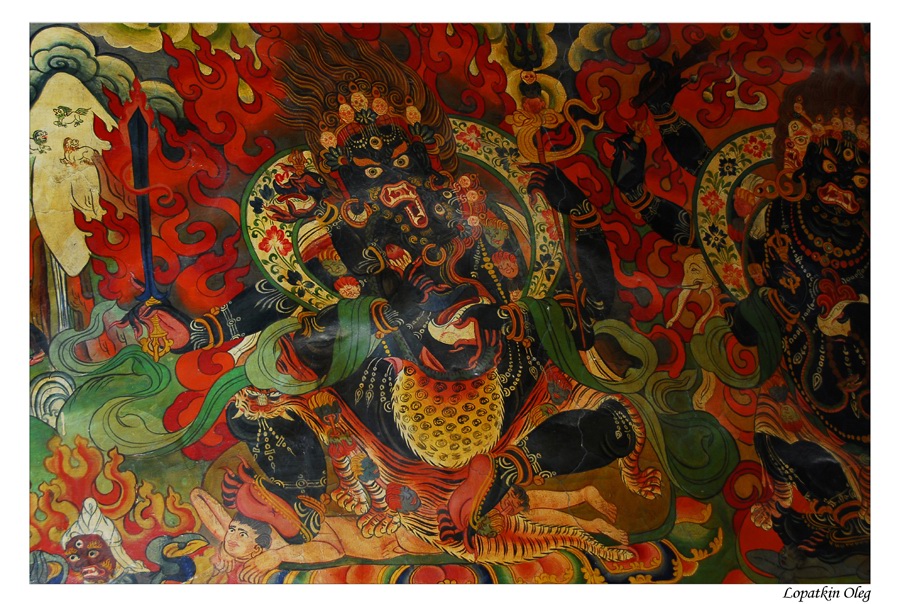 Painting in old monastery |
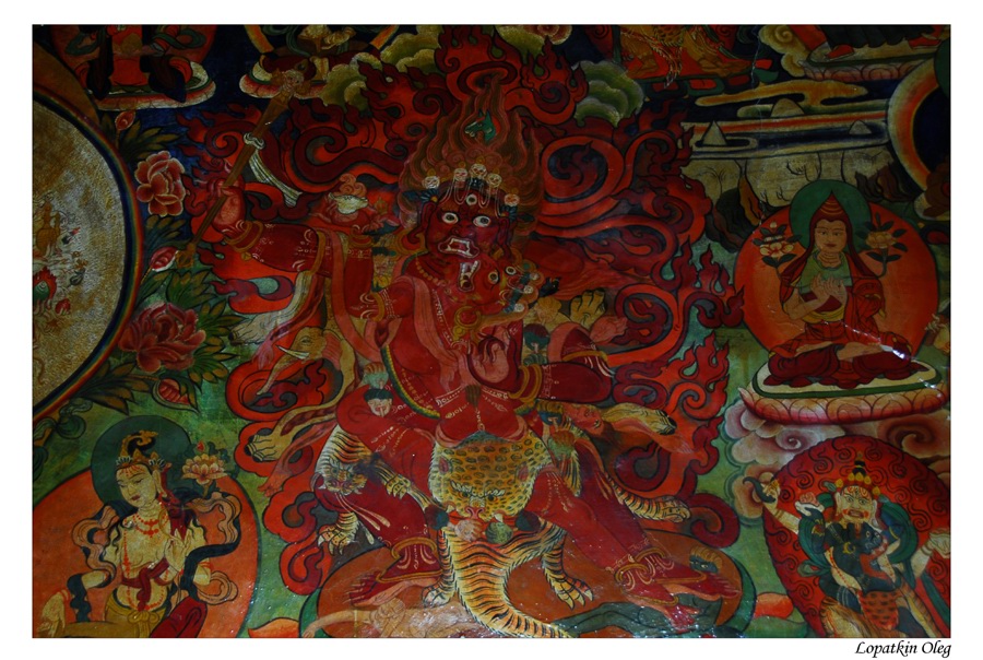 Painting in old monastery |
Day 14 Driving from Jomsom to Pokahra and overnight
there in the hotel
Day 15 Drivin from Pokahra to Kathmandu